Zhang Shiyi, Project Manager, Project Management Division, APFNet
Deforestation and forest degradation can happen rapidly and result in desertification, soil erosion, flooding and loss of crops. To take action on reducing deforestation, we need to know the true extent of tree loss but many public and private institutions have conflicting data on deforestation and its impacts on carbon emissions. These discrepancies make it difficult to set forest restoration targets and prepare sustainable forest management plans.
This article outlines four reasons that contribute to the differences in global forest cover estimates. They include the different definitions of ‘forest’, economies’ reluctance to report accurate data, technology limitations and research bias. Some suggestions on reducing data inconsistency in forest cover are provided.
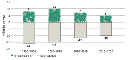
Annual rate of forest expansion and deforestation, 1990–2020.
What is a forest?
There are hundreds of forest definitions used throughout the world, incorporating a wide variety of attributes such as tree density, tree height, ecological functions, etc. to meet different forest management objectives. These different definitions cause inconsistency in estimating global forest cover, deforestation or emissions from land use change.
For example, the Food and Agriculture Organization of the United Nations (FAO) defines forests as “land spanning more than 0.5 hectares with trees higher than five metres and a canopy cover of more than 10 percent, or trees able to reach these thresholds in situ. It does not include land that is predominantly under agricultural or urban land use." If we use FAO’s definition, then China has gained 434,000 km2 of forests between 2000 and 2010. However, when using the definition for ‘remotely measurable gains in vegetation’ where a forest is defined as tree cover higher than five metres and at least 50 percent crown cover, China’s forest cover gain will only be 33,000 km2. Many economies have other definitions which produce similar gaps in forest cover estimation.
Self-reporting by economies
Deforestation data for FAO’s Global Forest Resources Assessment is self-reported by each economy every five years. There are many sociopolitical factors in each economy which affect land use decisions, including land ownership and management, economic development, trade, etc. Often forest cover loss can reflect the effectiveness and efficiency of an economy’s forest governance. These can be sensitive political issues.
Technology limitations
Measuring and monitoring forest change accurately is difficult and costly. Forest cover is often remotely sensed by satellite or aircraft, and spatially referenced using geographic information systems but no technology is perfect. For example, it is hard to distinguish between natural forest cover and tree crops by the Landsat satellite. Coarse spatial resolution imagery helps detect large-scale forest cover changes, but it is not capable to measure small-scale changes in deforestation and afforestation.
More subtle forest cover change can be detected by high-resolution remote sensing products, such as multi-resolution optical, synthetic aperture radar (SAR) or LiDAR but these tools are more costly. Not all organizations can afford to use the appropriate technology to measure forest cover changes accurately.
Research bias
Different research methods to collect and analyse data also generate discrepancies in global forest cover data. Some forest areas, for example biodiversity hotspots, receive more attention but other areas are excluded or overlooked due to an economy policy, poor study design or geographic location.
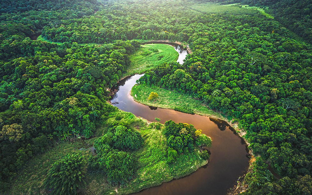
Tropical rainforest. Photo: Getty, The Telegraph
Reducing data discrepancies
Awareness of the differences between forest definitions will enable data gaps to be explained and resolved. Improving the accuracy of remote sensing tools and reducing their costs will help economies use these tools for forest reporting. The use of third-party consultants or research institutions can be helpful to improve transparency in an economy’s data collection and reporting. Research projects need to be carefully verified to ensure the study design is not biased.